About Aurangabad District
Aurangabad is one of the 38 districts of Bihar and is located in the southern part of the state within the historic Magadh region.
The district headquarters is Aurangabad town, which is connected to important road routes including the Grand Trunk Road corridor. The district is bordered by Arwal in the north, Palamu district of Jharkhand in the south, Gaya in the east and the Son River and Rohtas district in the west.
Aurangabad is predominantly agricultural, and many people depend on farming and related activities for their livelihoods. Magahi is widely spoken in the district alongside Hindi.
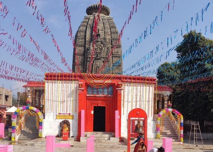
The district is particularly famous for its religious and historical attractions, with Deo Sun Temple being its best-known landmark.
History of Aurangabad
Aurangabad has deep historical connections with the ancient Magadh region, one of the most important political and cultural centres of ancient India.
The district administration’s historical account connects the region with ancient Magadh and mentions rulers such as Bimbisara, Ajatashatru, Chandragupta Maurya and Ashoka in the wider historical development of the area.
During the medieval period, the region came under different political powers. It became strategically significant during the period of Sher Shah Suri and was later incorporated into the Mughal administrative system.
After the decline of the Mughal Empire, local zamindars controlled different parts of the region. The district’s historical records mention estates and local centres including Deo, Kutumba, Mali, Pawai, Chandragarh and Siris.
The region also participated in resistance against British rule. Fateh Narayan Singh of Deo is recorded as having supported Kunwar Singh during the Revolt of 1857.
Aurangabad was initially part of the Bihar district and later became a subdivision. On 26 January 1973, Aurangabad was established as a separate district of Bihar. K. A. H. Subramanyam became its first District Magistrate.
Geography and Climate
Aurangabad lies in the plains of southern Bihar.
The district is situated on an alluvial plain, while the Son River lies approximately 20 km west of Aurangabad town. Other rivers and waterways associated with the district include the Punpun, Auranga, Bataane, Morhar and Madaar.
The district’s fertile plains support extensive agricultural activity.
Aurangabad experiences a typical Bihar climate with:
- Hot summers
- Monsoon rainfall
- Cooler winters
The summer months can be hot, while winter provides more comfortable conditions for sightseeing.
According to the district administration, October to March is the best period for touring Aurangabad.
Administration
Aurangabad is part of Magadh Division.
The district has two subdivisions:
There are 11 development blocks:
- Aurangabad
- Barun
- Navinagar
- Kutumba
- Madanpur
- Deo
- Rafiganj
- Obra
- Daudnagar
- Goh
- Haspura
The current official administrative setup confirms these 11 blocks and their respective subdivisions.
The district has approximately 1,884 villages and 32 police stations according to the current district profile.
Current District Magistrate
Smt. Abhilasha Sharma, IAS is currently listed as the District Magistrate and Collector of Aurangabad on the official district website.
Culture and Heritage of Aurangabad
Aurangabad’s culture is strongly influenced by the traditions of the Magadh region.
Magahi is an important local language, while Hindi is also widely spoken.
The district’s cultural identity is reflected in:
- Chhath Puja
- Hindu temple traditions
- Local fairs
- Agricultural festivals
- Islamic religious traditions
- Folk traditions of Magadh
- Traditional Bihari cuisine
The Deo Sun Temple is particularly important to the cultural identity of Aurangabad because of its association with Sun worship and the annual Chhath festival.
Aurangabad’s heritage is also diverse, with Hindu temples, Islamic pilgrimage sites, old forts and historic settlements spread across the district.
Religious Importance of Aurangabad
Aurangabad is one of Bihar’s important religious tourism districts.
The most famous religious site is the Deo Sun Temple, dedicated to the Sun God. Thousands of devotees gather at Deo during Chhath Puja.
Other important religious destinations include:
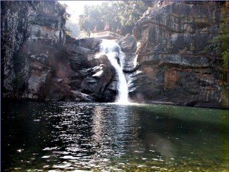
- Deo Kund
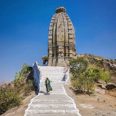
- Umga Temple
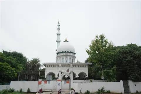
- Amjhar Sharif
- Deo Sun Temple
- Local Shiva temples
- Historic mosques and Islamic pilgrimage sites
This combination of Hindu and Islamic religious destinations gives Aurangabad a diverse spiritual landscape.
Tourism in Aurangabad
Tourism in Aurangabad is primarily based on religious heritage, ancient temples, historical sites and pilgrimage destinations.
The district administration identifies several major attractions, including:
- Deo
- Deo Kund
- Umga
- Amjhar Sharif
- Pawai
- Mali
- Chandangadh
- Piru
- Siris
The best-known attraction is undoubtedly the Deo Sun Temple, which attracts large numbers of devotees, particularly during Chhath.
Economy and Local Life
Agriculture is an important part of Aurangabad’s economy.
The district’s fertile plains support cultivation and agriculture-related activities. A significant portion of the population depends directly or indirectly on farming.
Important crops and agricultural products include:
- Rice
- Wheat
- Pulses
- Maize
- Oilseeds
- Vegetables
The district’s location along important highways also supports transportation, trade and local commerce.
Markets in Aurangabad, Daudnagar, Rafiganj, Deo and other towns serve surrounding rural areas.
Education in Aurangabad
Aurangabad has a growing network of schools, colleges and other educational institutions.
The district headquarters and major towns such as Aurangabad and Daudnagar serve as important educational centres.
Students from the district also travel to nearby Gaya, Bodh Gaya and Patna for higher education and specialised professional courses.
Education continues to be an important part of the district’s development, particularly because of its large rural population.
Famous Food of Aurangabad
The food culture of Aurangabad reflects traditional Magadhi and Bihari cuisine.
Popular foods include:
- Litti Chokha
- Sattu Paratha
- Sattu Sharbat
- Chura-Dahi
- Thekua
- Khaja
- Rice and Dal
- Seasonal vegetables
- Traditional Bihari sweets
During Chhath Puja, traditional offerings such as Thekua, fruits, rice-based preparations and other prasad are particularly important.
How to Reach Aurangabad
By Air
Nearest Active Airport: Gaya Airport (GAY)
For your website, I recommend using:
Nearest Active Airport: Gaya Airport (GAY)
Gaya Airport is the closest operational airport to Aurangabad, at approximately 58 km by road-distance estimates. Current airport information confirms that Gaya Airport is operational and has scheduled passenger service.
The Airports Authority of India currently lists IndiGo as operating scheduled flights from Gaya to Delhi and Kolkata. AAI also lists international airline operators at the airport, although some international services are seasonal.
Airport: Gaya Airport
IATA Code: GAY
Location: Gaya, Bihar
Approximate distance from Aurangabad: 58 km
Important: The current Aurangabad district website still lists Patna Airport as the nearest airport at 61 km, but that information conflicts with current geographic airport-distance data. Since you specifically asked me to use the nearest active airport, Gaya Airport is the better choice for this field.
By Train
The nearest railway station to Aurangabad city is Anugrah Narayan Road Railway Station (AUBR), approximately 9 km from Aurangabad city according to the district administration.
The station provides access to important railway routes connecting the region with other parts of Bihar and India.
By Road
Aurangabad has strong road connectivity.
Important highways serving the district include:
The Grand Trunk Road corridor provides connectivity towards major cities including Patna, Gaya, Varanasi, Kolkata and Delhi.
The official district website lists the road distance between Patna and Aurangabad at approximately 140 km.
Best Time to Visit Aurangabad
The best time to visit Aurangabad is October to March.
The winter season provides comfortable conditions for visiting temples, historical locations and rural attractions.
For devotees interested specifically in the Deo Sun Temple, the Chhath festival period is particularly significant, although the town can become extremely crowded during the festival.
The district administration also recommends October to March as the best tourism period.