About Araria District
Araria is one of the 38 districts of Bihar and is located in the northeastern part of the state. The district headquarters is Araria town, and the district forms part of Purnea division.
According to the 2011 Census figures published by the Araria district administration, the district has a population of 28,11,569 and covers approximately 2,830 square kilometres. The district has two subdivisions, Araria and Forbesganj, and nine blocks. These include Araria, Jokihat, Kursakanta, Raniganj, Sikti, Palasi, Forbesganj, Narpatganj and Bhargama.
Araria has a predominantly rural character, with agriculture forming an important part of the local economy. Paddy, maize and jute are among the major agricultural products of the district.
The district’s geography is strongly influenced by rivers and the wider floodplain environment of northeastern Bihar. Rivers including the Kosi, Suwara, Kali, Parmar and Koli are important geographical features of the region.
Araria also has a culturally diverse population. Hindi and Urdu are widely used, while local speech varieties such as Kulhaiya, Shekhra and Thethi contribute to the linguistic character of the district. Maithili, Bengali and Surjapuri are also spoken in different parts of the region.
History of Araria
Araria has a long and complex history influenced by different cultures and political powers.
The official district history records references to the region in passages of the Mahabharata, particularly descriptions associated with Bhima’s conquest of eastern India. Historically, the territory was influenced by several cultural groups, including the Kiratas in the north, the Pundras in the east and the Angas to the west of the Kosi region.
During the British period, the region became associated with European indigo cultivation and estates. A.J. Forbes, a military adventurer who was associated with the Bhagalpur administration during the 19th century, established the Sultanpur estate and several indigo factories in the region. The town of Forbesganj takes its name from him.
Araria also witnessed events connected with the Revolt of 1857, including clashes near Nathpur involving rebel forces and British troops.
Administratively, Araria became a subdivision in 1864, created by combining several smaller administrative areas. The region remained part of the larger Purnea district until Araria became an independent district in January 1990.
Geography and Climate
Araria is situated in northeastern Bihar and forms part of the fertile plains of the Seemanchal region.
The district shares boundaries with several districts of Bihar and lies close to the Nepal border region. Its geographical location gives Araria importance for regional trade and transportation, particularly through Forbesganj and Jogbani.
The major rivers associated with the district include:
- Kosi
- Suwara
- Kali
- Parmar
- Koli
These rivers contribute to the fertility of the land but also make parts of the district vulnerable to seasonal flooding.
Araria has a humid subtropical climate. Summers can be hot and humid, while the monsoon brings substantial rainfall. Winters are comparatively cooler and are generally more comfortable for travel.
For sightseeing and exploring outdoor attractions, October to March is generally a pleasant period to visit Araria.
Administration
Araria is the headquarters of both Araria district and the wider district administration under Purnea division.
The district has two subdivisions:
There are nine blocks:
- Araria
- Jokihat
- Kursakanta
- Raniganj
- Sikti
- Palasi
- Forbesganj
- Narpatganj
- Bhargama
The district administration oversees development, revenue, disaster management, public services, elections and other administrative functions.
According to the latest official Araria district administration information, Shri Vinod Duhan, IAS is serving as the District Magistrate of Araria. His office is located at the Collectorate Campus, Araria. The official office telephone number is 06453-222001.
Culture and Heritage of Araria
Araria has a distinctly multicultural identity influenced by the traditions of Bihar and neighbouring eastern regions.
Hindi is the official and widely used language, while Urdu is also an important language in the district. Local speech varieties including Kulhaiya, Shekhra and Thethi are part of the area’s cultural identity. Maithili, Bengali, Surjapuri and Bhojpuri are also spoken by communities in different parts of the district.
The district’s heritage reflects Hindu, Muslim and other cultural traditions. Temples, mosques and community institutions can be found across Araria and Forbesganj.
Important heritage and religious sites include the historic Thakurbari Shiva Temple in Araria, Kali Mandir, Sultan Phokhar in Forbesganj, Shiva temples at Madanpur and Sundernath, and several mosques including Jama Masjid and Quba Masjid.
This mixture of traditions gives Araria a cultural character that is different from many other districts of Bihar.
Religious Importance of Araria
Araria has a number of local religious destinations that are important to communities across the district.
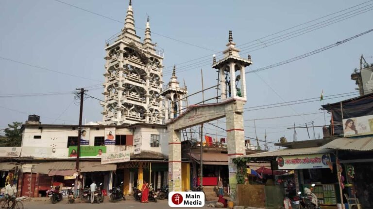
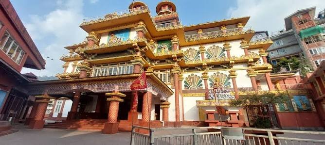
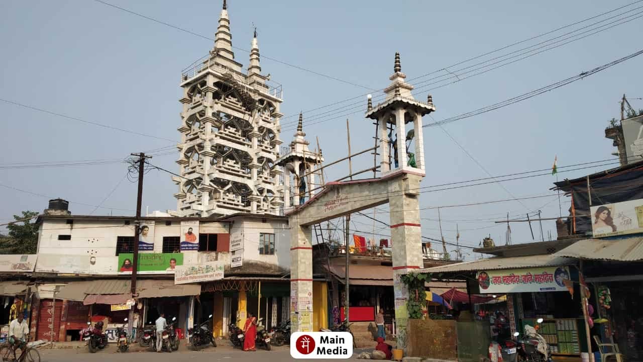
The Kali Mandir in Araria is a prominent temple and is known locally for its distinctive multi-storey structure.
The Thakurbari Shiva Mandir, located in the centre of Araria town, is another important religious site.
Other notable temples include:
- Shiva Mandir, Madanpur
- Sundernath Shiva Mandir
- Maata Aasawar Mandir, Gidwas
Forbesganj’s Sultan Phokhar is particularly notable because it holds significance for both Hindu and Muslim communities.
The district also has important mosques, including Jama Masjid and Quba Masjid, reflecting the religious diversity of Araria.
Tourism in Araria
Tourism in Araria is increasingly connected with nature, biodiversity, local heritage and cultural tourism.
Unlike districts such as Gaya or Nalanda, Araria does not primarily depend on large historical monuments for tourism. Instead, its appeal comes from its natural landscapes, biodiversity parks, local temples, cultural diversity and proximity to the Nepal border.
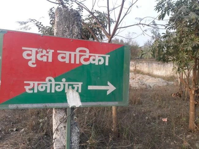
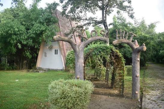
Two of the district’s most notable modern tourism attractions are Raniganj Vriksh Vatika and Kusiargaon Biodiversity Park.
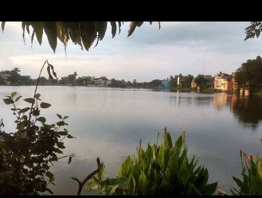
Raniganj Vriksh Vatika combines greenery, forest landscapes, a lake, bamboo structures and wildlife-related attractions. The official district tourism website highlights features including the Parn Sarovar, Bamboo Setum, Forest Science Centre and hog deer.
Kusiargaon Biodiversity Park is another important attraction. The district administration describes it as Bihar’s first biodiversity park, developed to support biodiversity conservation, research and tourism. It is located close to NH-57 and approximately 10 km from Araria district headquarters.
Economy and Local Life
Agriculture is the backbone of Araria’s economy.
The district has extensive cultivated land and supports crops such as:
- Paddy
- Maize
- Jute
- Wheat
- Pulses
- Seasonal vegetables
According to the official district profile, approximately 1,832.11 square kilometres are classified as cultivated area.
The agricultural economy supports a large rural population and is closely connected with local markets and small businesses.
Forbesganj and Jogbani are particularly important commercial centres because of their location near the Nepal border. Cross-border trade and transportation contribute to the economic importance of the region.
Small businesses, retail markets, transport services, agriculture-related activities and local trade form an important part of everyday economic life.
Education in Araria
Araria has a growing educational network serving students from both urban and rural areas.
The district has colleges and educational institutions providing higher education, while schools and government educational programmes serve communities throughout the nine blocks.
Forbesganj and Araria town are important educational centres within the district.
The district administration’s current profile lists three colleges/university-level institutions among its public-utility information.
Education remains an important area of development because a large part of the district’s population lives in rural areas.
Famous Food of Araria
The food culture of Araria reflects the culinary traditions of northeastern Bihar and the wider Seemanchal region.
Popular foods and everyday dishes include:
- Litti Chokha
- Sattu Paratha
- Sattu Sharbat
- Chura-Dahi
- Thekua
- Khaja
- Rice and dal
- Seasonal vegetable preparations
- Fish curry
- Local sweets
Because of the district’s agricultural environment and proximity to Bengal and other eastern regions, local food can show influences from several neighbouring culinary traditions.
Traditional rice-based meals, vegetables, fish and seasonal produce are common in many households.
How to Reach Araria
By Air
The nearest domestic airport identified by the latest official Araria district travel information is Purnea Airport, located at Goasi (Chunapur), approximately 50 km from Araria district headquarters.
The airport provides a convenient air connection for Araria and the surrounding Seemanchal region.
Nearest Airport: Purnea Airport
For international air travel, Bagdogra Airport in West Bengal is another major option and is approximately 145 km from Araria district headquarters, according to the district administration.
By Train
Araria has broad-gauge railway connectivity.
The main railway stations serving the district headquarters area are:
The railway line connects the region towards Katihar on one side and Jogbani on the other. Jogbani is located near the India-Nepal border and is an important railway terminus.
By Road
Araria is connected by road with other parts of Bihar through major highways, including the NH-57 corridor.
The district has two important bus terminals, including the Zero Mile bus stand and another bus stand within Araria city.
Regular buses connect Araria with other districts and with several blocks within the district.
Best Time to Visit Araria
The best time to visit Araria is generally from October to March, when the weather is more comfortable for sightseeing and outdoor activities.
Winter is particularly suitable for visiting:
- Raniganj Vriksh Vatika
- Kusiargaon Biodiversity Park
- Local temples
- River and countryside areas
- Forbesganj
Visitors interested in nature and photography may prefer the cooler months when outdoor conditions are more pleasant.
During the monsoon season, some parts of the district can experience waterlogging or flooding because of the region’s river systems, so travellers should check local conditions before planning rural excursions.